Spatio-temporal analysis of landscape changes in different land use – Chukwudi NWAOGU
Chukwudi NWAOGU
Doctoral thesis
Spatio-temporal analysis of landscape changes in different land use
Predictive modeling of land-use in Central Europe
Abstract:
The aim of this thesis was to analyzing landscape changes by identifying the changes, the drivers of the changes, and impacts on the land resources in different land use using GIS in combination of some statistical techniques. The first part of the work focused on the introduction and definition of the core concepts in relation to landscape changes. For examples, landscapes types and change drivers …moreAbstract:
The aim of this thesis was to analyzing landscape changes by identifying the changes, the drivers of the changes, and impacts on the land resources in different land use using GIS in combination of some statistical techniques. The first part of the work focused on the introduction and definition of the core concepts in relation to landscape changes. For examples, landscapes types and change drivers …more
Language used: English
Date on which the thesis was submitted / produced: 25. 8. 2018
Thesis defence
- Date of defence: 6. 9. 2018
Citation record
ISO 690-compliant citation record:
NWAOGU, Chukwudi. \textit{Spatio-temporal analysis of landscape changes in different land use}. Online. Doctoral theses, Dissertations. Olomouc: Palacký University Olomouc, Faculty of Science. 2018. Available from: https://theses.cz/id/iky5c3/. [citováno 2024-04-23]
The right form of listing the thesis as a source quoted
NWAOGU, Chukwudi. Spatio-temporal analysis of landscape changes in different land use. Olomouc, 2018. disertační práce (Ph.D.). UNIVERZITA PALACKÉHO V OLOMOUCI. Přírodovědecká fakulta
Full text of thesis
Contents of on-line thesis archive
Published in Theses:- světu
Other ways of accessing the text
Institution archiving the thesis and making it accessible: UNIVERZITA PALACKÉHO V OLOMOUCI, Přírodovědecká fakultaPALACKÝ UNIVERSITY OLOMOUC
Faculty of ScienceDoctoral programme / field:
Geography / Geoinformatics and Cartography
Theses on a related topic
-
Wind Erosion Modelling Using GIS
Jade Zierden -
Surface runoff modelling using the SCS-CN method and delineation of flood extents by a non-hydrodynamic GIS tool
Martin Caletka -
GIS-BASED SOLAR PHOTOVOLTAIC POTENTIAL MODELLING IN THE URBAN AREA
Rochamukti RIZCANOFANA -
Možnosti prediktivního modelování lesních požárů pomocí GIS
Petr Vodička -
Modelling of spruce forest decay caused by the European spruce bark beetle in the area of Bohemian Forest using GIS
Zdeněk BROŽ -
Využití modelování v GIS při studiu vývoje krajiny
Tomáš Šťastný -
Využití GIS nástrojů při modelování rozšíření vybraných druhů suchozemských plžů v CHKO Bílé Karpaty
Šárka Špániková -
Využitelnost modulů GIS pro účely krajiných úprav
Daniela Fogašová
Name
Posted by
Uploaded/Created
Rights
-
Co je jinak přidání souboru
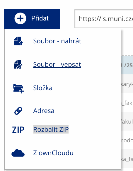 Soubor nebo složku lze nahrát pomocí tlačítka Přidat.
 -
Co je jinak další operace se soubory
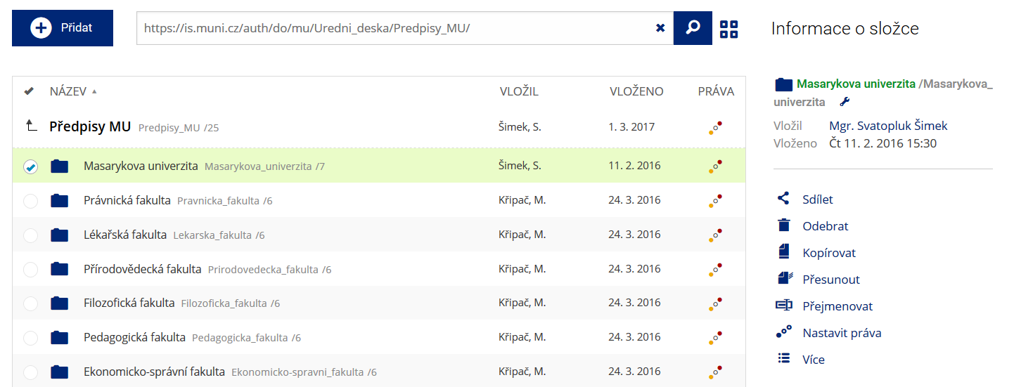 Podrobnosti lze zjistit označením příslušného řádku.
 -
Co je jinak pohled pro experty
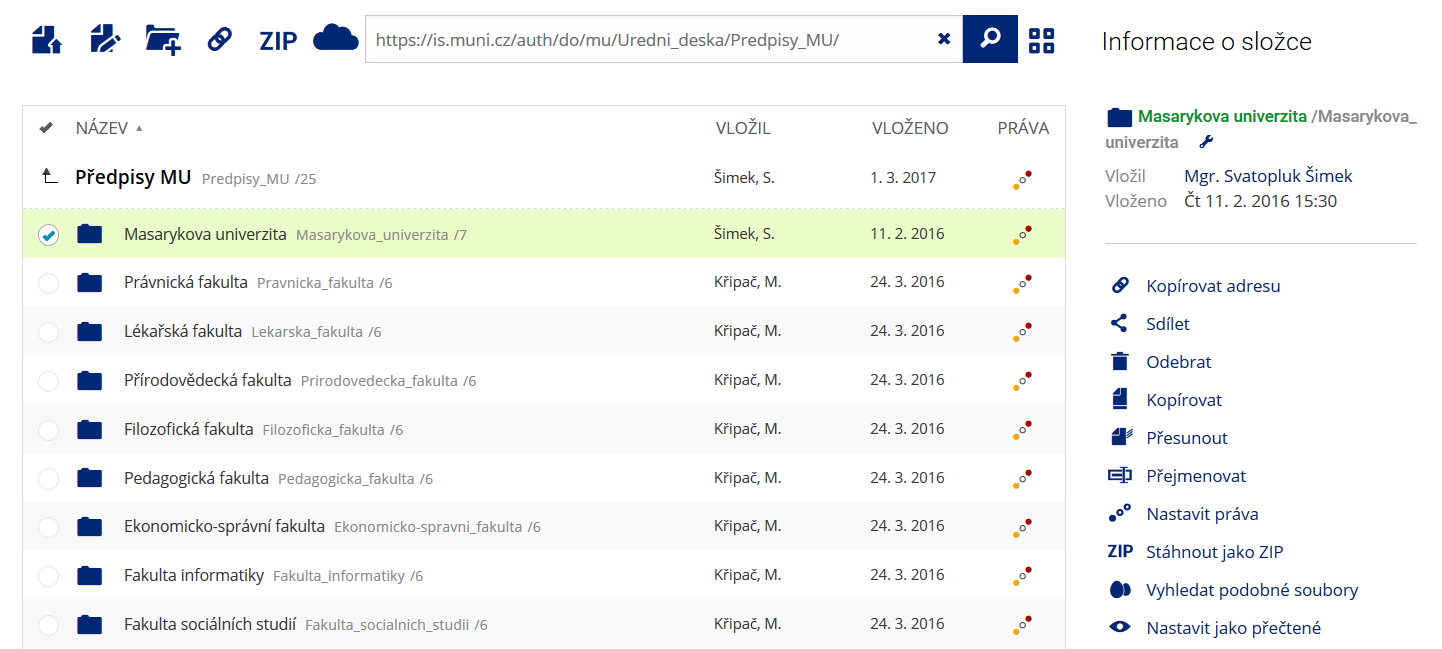 Pro častou práci je možné zvolit režim Více možností.
 -
Co je nové vyhledávání souborů
 Vyhledávaný výraz můžete zadat přímo do adresního řádku.
 -
Co je nové rychlý přístup k souborům
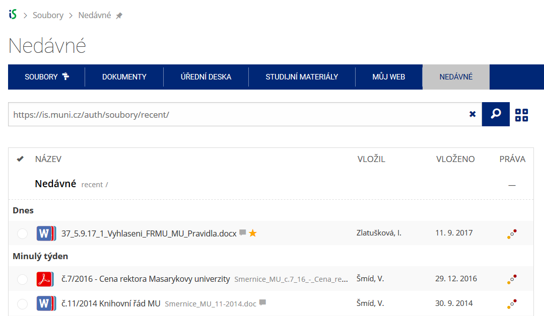 Pomocí funkce Nedávné je možné se rychle vrátit k právě prohlíženým souborům. Oblíbené soubory je také možné označit Hvězdičkou.
 -
Co se chystá
 Připravujeme další vylepšení pro mobilní zařízení.