Copernicus Data in Sustainable Development Goals using Image Maps – Sushmita SUBEDI
Sushmita SUBEDI
Master's thesis
Copernicus Data in Sustainable Development Goals using Image Maps
Copernicus Data in Sustainable Development Goals using Image Maps
Abstract:
The main goal of the thesis is to design and compile a set of image maps from the data of the Copernicus project and thereby demonstrate the applicability of satellite data to support solutions to the selected Sustainable Development Goals. The research allows to enhance the accessibility, availability, and utilization of Copernicus as a free and open-source earth observation data, with a view to foster …moreAbstract:
The main goal of the thesis is to design and compile a set of image maps from the data of the Copernicus project and thereby demonstrate the applicability of satellite data to support solutions to the selected Sustainable Development Goals. The research allows to enhance the accessibility, availability, and utilization of Copernicus as a free and open-source earth observation data, with a view to foster …more
Language used: English
Date on which the thesis was submitted / produced: 25. 5. 2023
Thesis defence
- Supervisor: prof. RNDr. Vít Voženílek, CSc.
Citation record
The right form of listing the thesis as a source quoted
SUBEDI, Sushmita. Copernicus Data in Sustainable Development Goals using Image Maps. Olomouc, 2023. diplomová práce (Mgr.). UNIVERZITA PALACKÉHO V OLOMOUCI. Přírodovědecká fakulta
Full text of thesis
Contents of on-line thesis archive
Published in Theses:- světu
Other ways of accessing the text
Institution archiving the thesis and making it accessible: UNIVERZITA PALACKÉHO V OLOMOUCI, Přírodovědecká fakultaPalacký University Olomouc
Faculty of ScienceMaster programme / field:
Geoinformatics and Cartography / Geoinformatics and Cartography
Theses on a related topic
-
Portrayal of likely climate change impacts on beekeeping based on earth observation data
Yuan WANG -
Visualization and Analysis of Historical Data in GIS
Adam Mertel -
Docházková vzdálenost k zastávce dopravní obslužnosti v obcích mikroregionu Telčsko, vyjádřená pomocí GIS.
Pazour Pazour -
Možnosti prediktivního modelování lesních požárů pomocí GIS
Petr Vodička -
Implementace DPZ a GIS v humanitární pomoci a rozvojové spolupráci
Simona Bočková -
Surface runoff modelling using the SCS-CN method and delineation of flood extents by a non-hydrodynamic GIS tool
Martin Caletka -
Tvorba turistického portálu mikroregionu Kahan s využitím GIS
Erik Mühlberger -
Sestavení pocitové mapy v prostředí GIS vybraného města, jako prostředku komunikace veřejné správy s občany s důrazem na bezpečnost ve městě
Libuše Dvořáková
Name
Posted by
Uploaded/Created
Rights
-
Co je jinak přidání souboru
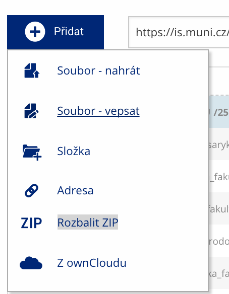 Soubor nebo složku lze nahrát pomocí tlačítka Přidat.
 -
Co je jinak další operace se soubory
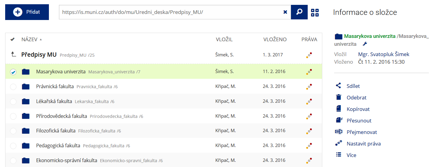 Podrobnosti lze zjistit označením příslušného řádku.
 -
Co je jinak pohled pro experty
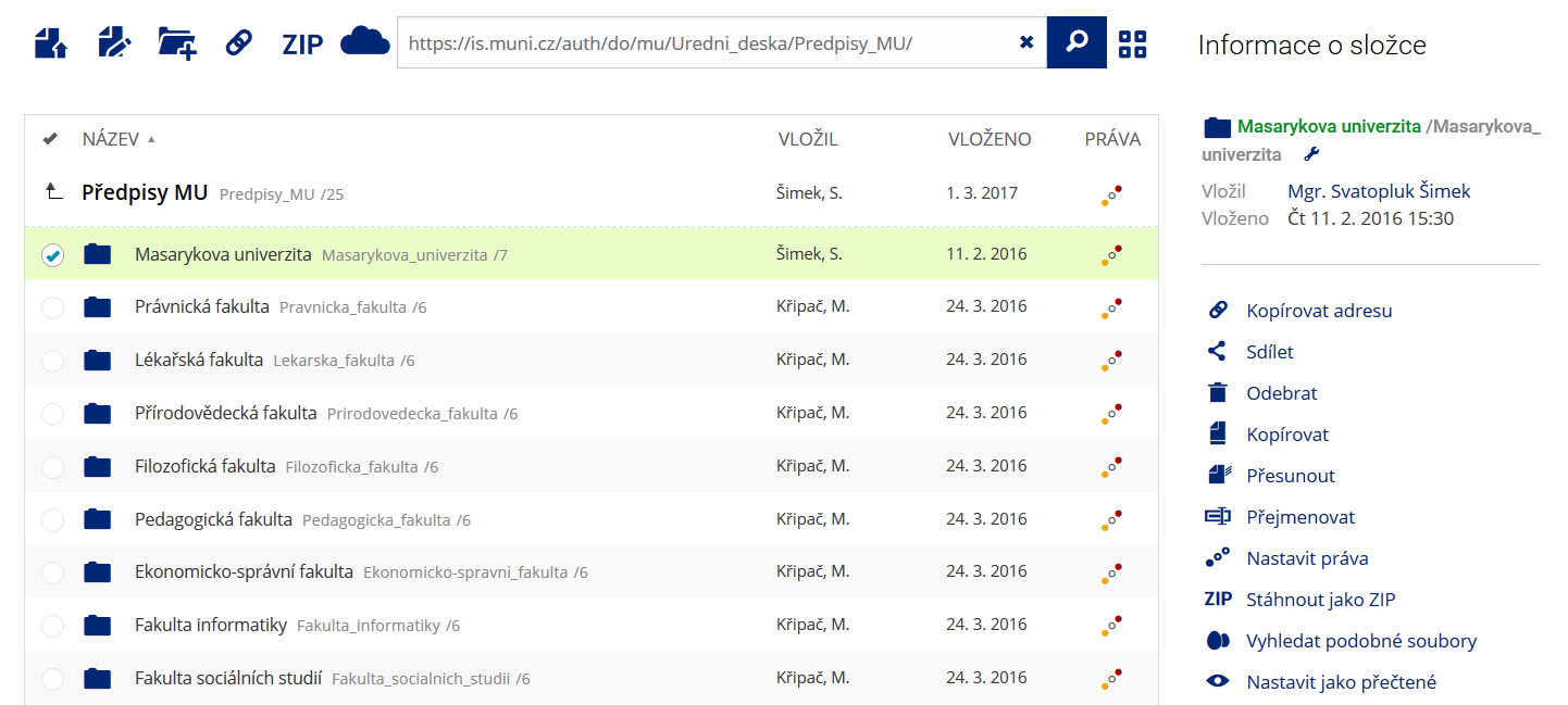 Pro častou práci je možné zvolit režim Více možností.
 -
Co je nové vyhledávání souborů
 Vyhledávaný výraz můžete zadat přímo do adresního řádku.
 -
Co je nové rychlý přístup k souborům
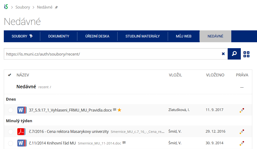 Pomocí funkce Nedávné je možné se rychle vrátit k právě prohlíženým souborům. Oblíbené soubory je také možné označit Hvězdičkou.
 -
Co se chystá
 Připravujeme další vylepšení pro mobilní zařízení.