Využití GIS nástrojů pro analýzu dat z oblasti zemědělství – Bc. Jan Ctibor
Bc. Jan Ctibor
Master's thesis
Využití GIS nástrojů pro analýzu dat z oblasti zemědělství
Usage of GIS tools for agriculture data analysis
Abstract:
Diplomová práce se zabývá využitím geografických informačních systémů (zkr. GIS) pro analýzu dat z oblasti zemědělství. Hlavním cílem bylo vytvoření interaktivní webové aplikace ve formě storymapy, která vizualizuje a analyzuje data o rozložení plodin na území České republiky. Za tímto účelem byly využity nástroje z ekosystému ESRI, konkrétně ArcGIS Pro, Insights, Map Viewer a StoryMaps. Teoretická …moreAbstract:
This thesis focuses on the application of Geographic Information Systems (GIS) for analyzing data in the field of agriculture. The primary objective was to create an interactive web application in the form of a storymap that visualizes and analyzes data on crop distribution across the Czech Republic. To achieve this, tools from the ESRI ecosystem were utilized, specifically ArcGIS Pro, Insights, Map …more
Language used: Czech
Date on which the thesis was submitted / produced: 4. 4. 2025
Thesis defence
- Date of defence: 26. 5. 2025
- Supervisor: Ing. Jakub Konopásek, Ph.D.
- Reader: Olga Špatenková, D.Sc.
Citation record
ISO 690-compliant citation record:
CTIBOR, Jan. \textit{Využití GIS nástrojů pro analýzu dat z oblasti zemědělství}. Online. Master's thesis. Praha: Czech University of Life Sciences Prague, Faculty of Economics and Management. 2025. Available from: https://theses.cz/id/ezximn/.
Full text of thesis
Contents of on-line thesis archive
Published in Theses:- světu
Other ways of accessing the text
Institution archiving the thesis and making it accessible: Česká zemědělská univerzita v Praze, Provozně ekonomická fakultaCzech University of Life Sciences Prague
Faculty of Economics and ManagementMaster programme:
Informatika
Theses on a related topic
-
Spatial analysis and visualization of social media data
Jiří Hladík -
Library for 2D visualization of Hi-C data
Patrik Bašo -
Time-variable Visualization from Sensor Data Inside Building in a 3D GIS Environment
Jan MACURA -
Vizualizace prostorových Big Data
Jáchym KELLAR -
Spatial data structures for point cloud analysis and visualization
Vojtěch Uher -
Infrastructure and support tools for processing and analyzing large structured data
Denis Straňák -
Analysis of Traditional and "Non-Traditional" Data Used to Improve the Management of Emergencies in the Czech Republic and Abroad
Pavel Špulák -
Zpracování a vizualizace dat z on-line dotazníkového šetření v oblasti soukromí
Martin Řehka
Name
Posted by
Uploaded/Created
Rights
Theses ezximn ezximn/4
3/4/2025
Folders
Files
-
Přidání souboru
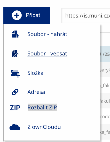 Soubor nebo složku lze nahrát pomocí tlačítka Přidat.
 -
Další operace se soubory
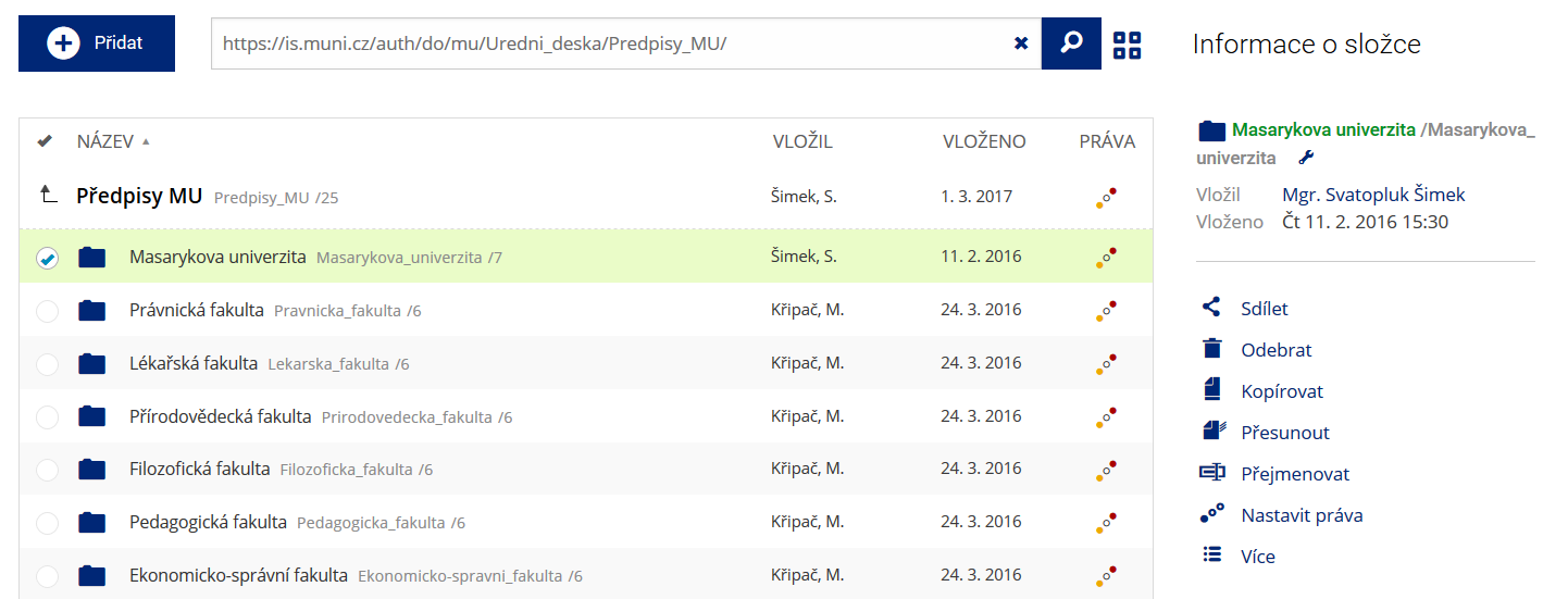 Podrobnosti lze zjistit označením příslušného řádku.
 -
Pohled pro experty
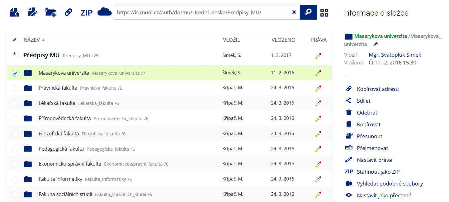 Pro častou práci je možné zvolit režim Více možností.
 -
Vyhledávání souborů
 Vyhledávaný výraz můžete zadat přímo do adresního řádku.
 -
Rychlý přístup k souborům
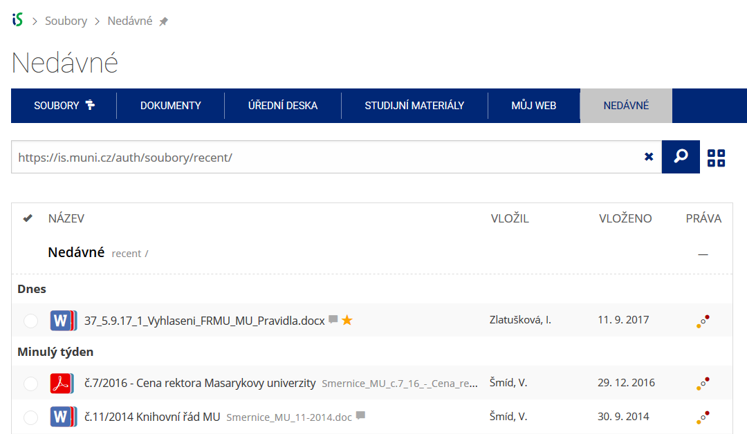 Pomocí funkce Nedávné je možné se rychle vrátit k právě prohlíženým souborům. Oblíbené soubory je také možné označit Hvězdičkou.