Evaluation of varying trajectories of cultural landscape development – B.Sc. Zafer Karakaya
B.Sc. Zafer Karakaya
Master's thesis
Evaluation of varying trajectories of cultural landscape development
Abstract:
Horní Záblatí, Sviňovice and Zdenice are growing and developing due to migration due to various reasons where you can find around the Prachatice. This growth has led to the formation of a new center that brings together many business and social spaces that have developed and expanded with the spread of the sites as well as the village centers, which preserves its old structure. The villages are growing …more
Language used: English
Date on which the thesis was submitted / produced: 10. 12. 2018
Thesis defence
- Supervisor: Ing. Kristina Janečková, Ph.D.
Citation record
ISO 690-compliant citation record:
KARAKAYA, Zafer. \textit{Evaluation of varying trajectories of cultural landscape development}. Online. Master's thesis. Praha: Czech University of Life Sciences Prague, Faculty of Environmental Sciences. 2018. Available from: https://theses.cz/id/sh5315/.
Full text of thesis
Contents of on-line thesis archive
Published in Theses:- světu
Other ways of accessing the text
Institution archiving the thesis and making it accessible: Česká zemědělská univerzita v Praze, Fakulta životního prostředíCzech University of Life Sciences Prague
Faculty of Environmental SciencesMaster programme / field:
Landscape Engineering / Landscape Planning
Theses on a related topic
-
Využití ArcGIS Survey123 v projektové výuce zeměpisu na 2. stupni ZŠ
Vlastimil Novák -
Využití analytických nástrojů ArcGIS Online v učebních úlohách
Vendula Mašterová -
Práce v ArcGIS StoryMaps ve výuce na střední škole. Modelové téma: Stárnutí populace
Luboš Bartík -
Zhodnocení využitelnosti ArcGIS Field Maps v terénní výuce zeměpisu
Lubomír Molák -
Digitální zpracování anizotropie stavby mapovaného území a její vizualizace v prostředí ArcGIS
Lenka Kociánová -
Využití ArcGIS Online ve výuce zeměpisu na ZŠ
Eliška Valkovičová -
Porovnání úspěšnosti žáků II. stupně základních škol při práci s mapami vytvořenými v programe ArcGIS s mapami v klasických školních atlasech
Mariana Hájková
Name
Posted by
Uploaded/Created
Rights
-
Co je jinak přidání souboru
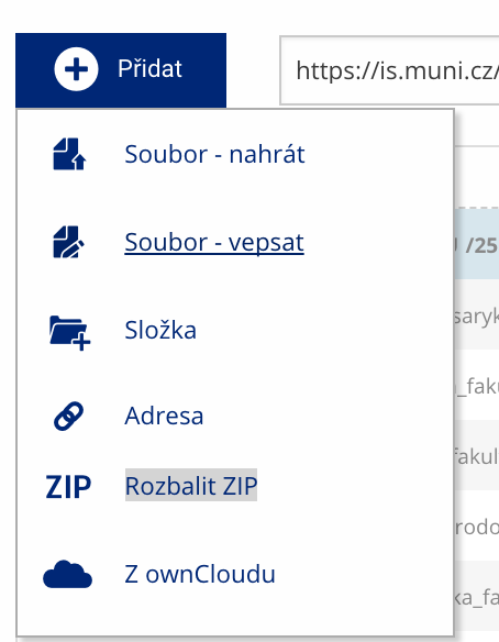 Soubor nebo složku lze nahrát pomocí tlačítka Přidat.
 -
Co je jinak další operace se soubory
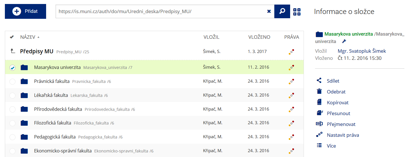 Podrobnosti lze zjistit označením příslušného řádku.
 -
Co je jinak pohled pro experty
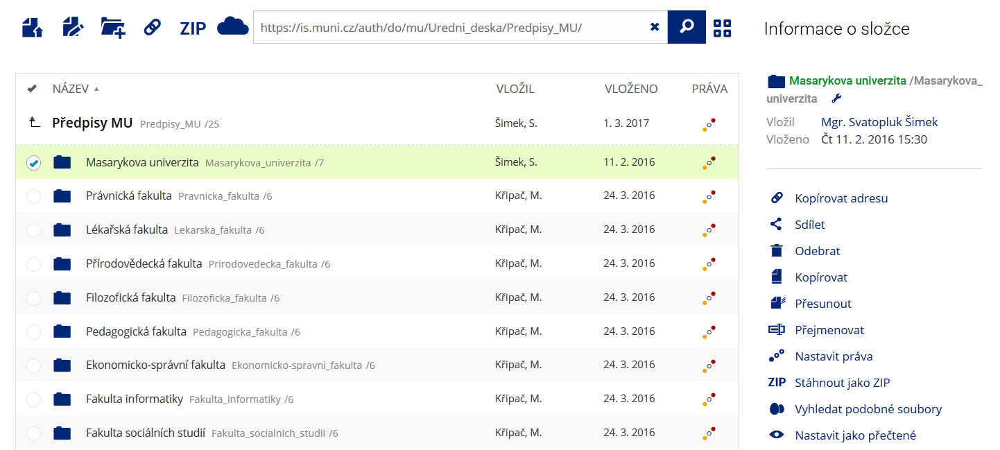 Pro častou práci je možné zvolit režim Více možností.
 -
Co je nové vyhledávání souborů
 Vyhledávaný výraz můžete zadat přímo do adresního řádku.
 -
Co je nové rychlý přístup k souborům
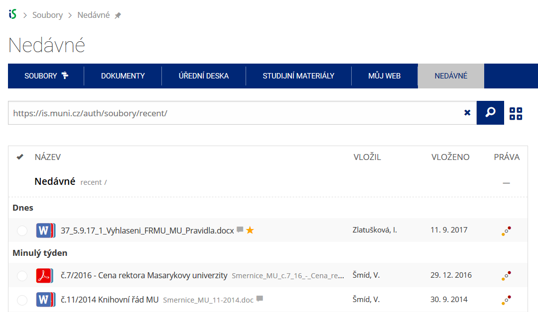 Pomocí funkce Nedávné je možné se rychle vrátit k právě prohlíženým souborům. Oblíbené soubory je také možné označit Hvězdičkou.
 -
Co se chystá
 Připravujeme další vylepšení pro mobilní zařízení.